

A new study has found that fresh forest clearing in the tropics can be detected up to 100 days sooner than light-based satellite systems allow.
That earlier warning narrows a dangerous blind spot, because cut forest can green over before standard records ever capture the loss.
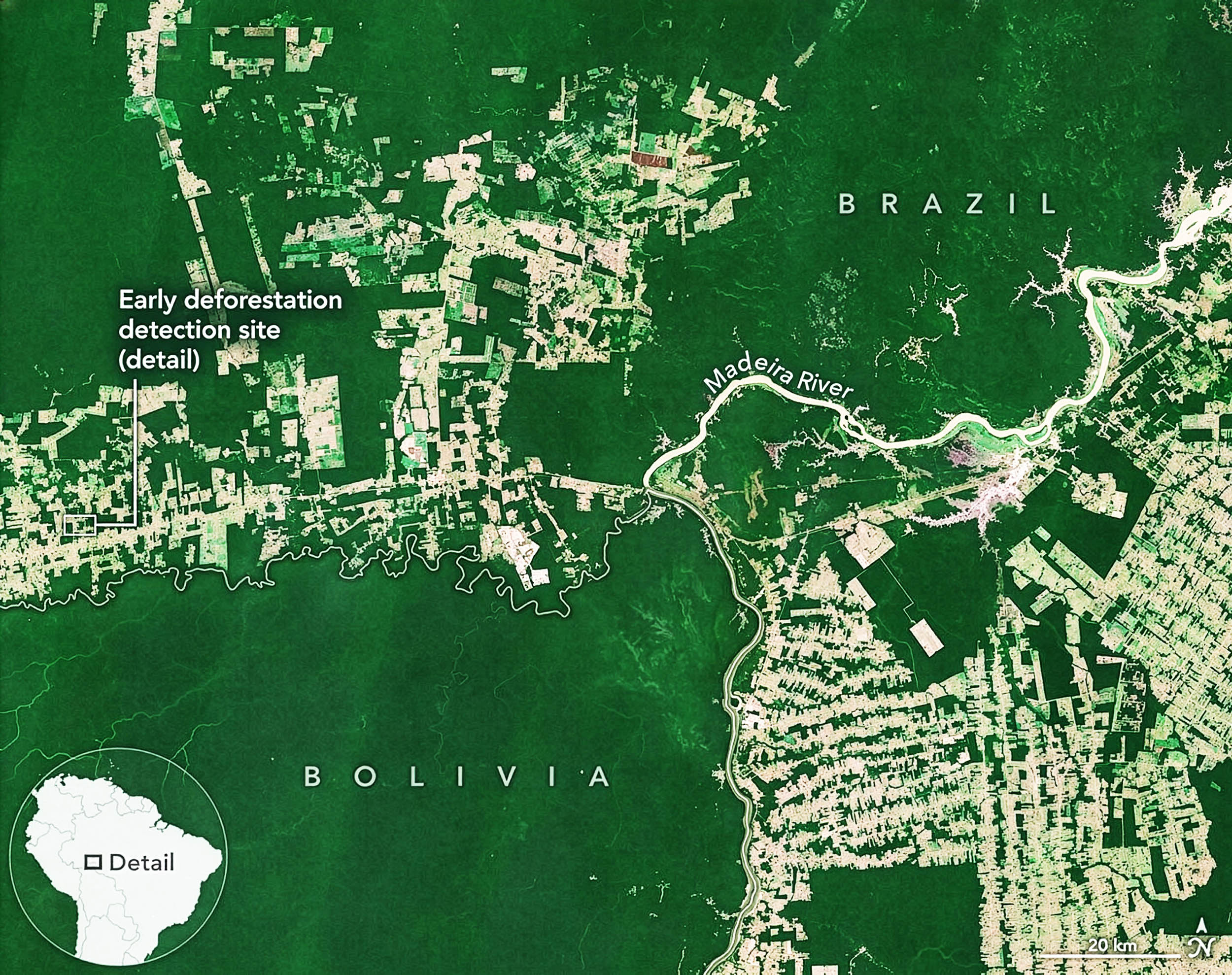
Forest clearing in Brazil

In southwest Brazil, small openings in tropical forest appeared in satellite records while ordinary images still struggled against cloud cover.
By tracing those hidden changes, Africa I. Flores-Anderson at NASA’s Marshall Space Flight Center demonstrated that radar could catch fresh cuts before they disappeared from view.
The signal was strongest during the first stage of clearing, when trunks and branches still lay where loggers dropped them.
That narrow window explains why faster detection matters, and why older forest alerts can miss damage that later looks like regrowth.
Why clouds matter
Older forest alerts depend heavily on optical satellites, spacecraft that read sunlight reflected from the ground.
Clouds break that approach, because thick tropical weather hides the ground even when trees are gone.
For more than 50 years, Landsat, a U.S. land-imaging satellite program, has helped governments track changing land from space.
In wet tropical regions, that strong record can still leave gaps long enough for illegal clearing to continue.
Seeing through clouds
Radar changes timing because synthetic aperture radar, or SAR, can “see” through clouds.
Shorter C-band, a common radar wavelength range, scatters off treetops and leftover branches after cutting.
Longer L-band, a deeper-reaching radar wavelength range, can reach lower forest structure and exposed ground.
“L-band SAR gives us the opportunity to see what optical doesn’t,” said Sylvia Wilson, chief forest and climate scientist at Wilpa Capacity Development, an organization focused on forest monitoring.
Radar and forest clearing index
Numbers made the difference sharper when the team compared radar signals from intact and newly logged forest.
The radar forest degradation index, a measure that compares returned radar signals, responded strongly when branches stayed on the ground.
Tests across 92 forest locations in southwest Brazil over three years found L-band signals distinguished fresh logging from intact forest better than C-band signals.
Even so, the result did not turn radar into a perfect answer, because flooded forest sometimes looked falsely damaged.
 Scientists pioneered a new system that combines data from multiple Earth-observing satellites to identify forest clearing up to 100 days earlier than current methods. Credit: NASA. Click image to enlarge.Accuracy without panic
Speed only helps if alerts stay trustworthy, since false alarms can waste money and weaken enforcement.
To keep mistakes down, the model confirmed clearing only after repeated signs of loss from different observations.
A related system that combines data from several satellites correctly identified cleared areas 99.19% of the time and detected them in about 16 days on average.
Very cloudy areas could receive warnings up to 100 days earlier than optical-only systems, giving responders more time to act.
Forest structure and tree canopy
Fresh forest clearing often begins with cut trees lying under broken canopy, not bare soil.
That messy stage changes forest structure, yet short radar waves still bounce from debris that masks the damage.
“If an image of a cleared forest isn’t available until the following year, the area may already be regrown, and deforestation will be missing from our data,” said Flores-Anderson.
Earlier alerts create a narrow window before fires, regrowth, or new farms hide the sequence of damage.
NASA partners with India
Faster alerts will face their real-world test as NISAR, a radar satellite for tracking Earth, expands coverage beyond special study areas.
NASA and India’s space agency built a new satellite called NISAR, which launched on July 30, 2025.
It will scan land and ice around the world every 12 days, giving scientists regular, up-to-date views of changes on Earth.
Regular 12-day coverage could give models fresh radar views before old gaps erase early evidence.
Human stakes grow
The Food and Agriculture Organization of the United Nations (FAO) reported about 42,000 square miles of yearly deforestation from 2015 to 2025.
That scale turns speed into more than a technical upgrade, because early proof can guide patrols and land claims.
Communities, conservation groups, and agencies need alerts while roads, smoke, and ownership conflicts can still be checked.
Delayed records can make a fresh loss look like old land use, which weakens accountability after the fact.
Forest clearing, radar, and future tech
Better radar will not settle every forest dispute, because an alert still needs local interpretation.
Flooded forests can confuse radar by sending strong returns that resemble the rough structure of cutting.
Older L-band radar satellites did not pass over the same areas very often, which slowed how quickly changes could be spotted.
Future systems will need masks for seasonal flooding and careful checks before enforcement actions follow.
By catching first damage sooner, the system links what satellites see to the moment when people can still act.
Better public radar data could sharpen forest protection, but field checks and local knowledge must keep the alerts honest.
The study is published in Remote Sen
—–
Like what you read? Subscribe to our newsletter for engaging articles, exclusive content, and the latest updates.
Check us out on EarthSnap, a free app brought to you by Eric Ralls and Earth.com.
—–