

Europe is preparing to deploy a set of science satellites not only to improve weather forecasting but also to provide timely alerts about severe events, such as floods and fires.
The efforts aim to mitigate the loss of life and billions of dollars in economic harm. A trio of missions is set to launch in the coming months, and funding was secured late last year for future efforts. Together, these developments underscore that Europe is overtaking the U.S. in earth science and generating widely shared data.
New Meteosat spacecraft promises more timely data updatesFlex mission will detect the faint fluorescent signals that plants emit during photosynthesis
The Trump administration fiscal 2027 budget plan cuts funding for NASA science missions and for the National Oceanic and Atmospheric Administration, terminating what it called “green new scam” programs. China, by contrast, is investing in earth science efforts; for instance, it launched a greenhouse gas detection satellite on April 17 into sun-synchronous orbit, although Beijing has generally been less open with the data it collects.
Thales Alenia Space is finishing up integration and testing of three Earth-observation satellites that will be shipped for launch from the European spaceport in Kourou, French Guiana. The first that is due to fly is the Meteosat Third-Generation MTG-I2 imaging spacecraft that Arianespace is set to deploy with the VA270 mission using an Ariane 62 rocket in August.
The satellite that is due for commissioning early next year will round out the first iteration of the new Meteosat system for European weather agency Eumetsat. It complements MTG-I1, another imager launched in December 2022, and MTG-S1, an infrared sounding satellite that measures temperature, humidity and wind, launched in July.
MTG-I2, which has a launch mass of 3.8 metric tons, will be placed in geostationary Earth orbit and will provide updated images of European weather every 2.5 min. MTG-I1 looks at the globe every 10 min. The higher update rate could allow for alerts to first responders, including for fire events, European officials note.
The goal of more instantaneous weather forecasting is, in part, to reduce economic losses from extreme events that have caused more than $250 billion in damages this decade alone, says Susanne Dieterle, manager of Eumetsat MTG.
The main instruments on the MTG-I2 are its Flexible Combined Imager, with 16 spectral channels in visible and infrared light, and the Lightning Imager, developed by Leonardo. The Lightning Imager can help monitor how storm intensity builds up and abates, says Fabio Brandani, who runs Leonardo’s space payloads and sensors business. It could also offer more tangible benefits, he suggests, such as helping airlines reroute flights to avoid storms.
The satellite has fuel for almost 11 years of service. Next year, the European Space Agency (ESA) and Eumetsat are set to begin talks about defining requirements for the fourth-generation system, James Champion, ESA program manager, says.
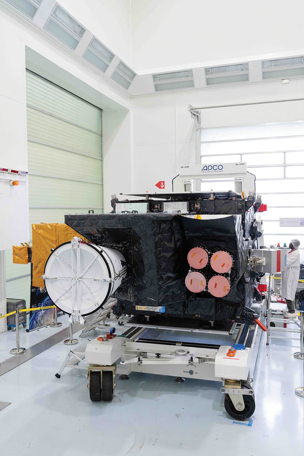
The MTG-I2 satellite will produce images for weather forecasting in Europe and feature a novel lightning imager. Credit: ESA
In September, ESA plans to deploy the 400-kg (880-lb.) Fluorescence Explorer (Flex) mission on an Avio Vega C rocket, along with the 1,140-kg Sentinel-3C satellite to assess sea and land surfaces as part of the European Commission’s Copernicus program. The two satellites will fly in tandem at about 815 km (506 mi.), and Sentinel will provide key information to support Flex, which will fly 6-15 sec. ahead of the larger satellite.
Flex is an unusual mission. The spacecraft aims to monitor plant health from space by detecting the faint fluorescent signals plants create during photosynthesis, says Dirk Bernaerts, ESA head of Earth Explorer missions. The satellite that collects data in the 500-780-nm spectral range is due for 3.5 years of life. In-orbit commissioning should wrap up this year.
Data from Sentinel will be used to help tease out the extremely weak fluorescent signals that Flex will collect.
The Sentinel-3C satellite will replace Sentinel-3A, launched a decade ago, and is part of a constellation of two satellites. Sentinel-3D is due for launch in 2029 to replace Sentinel-3B. The Sentinel-3 spacecraft will operate in the same orbital plane, separated by 140 deg.
Sentinel-3C’s main instruments are the ocean and land color instrument, sea and land surface temperature radiometer, synthetic aperture radar altimeter and microwave radiometer. They are part of a European long-term climate-monitoring effort and include the ability to measure land and sea ice, as well as river and lake water height, using altimetry measurements. Optical sensors support land surface temperature data collection and other inputs.
Sentinel-3C and Flex will perform somewhat of an orbital dance during the initial calibration and commissioning phase. Post-deployment, Sentinel-3C is due to fly close to Sentinel-3B for sensor calibration. Flex will fly toward Sentinel-3A for its initial checks. Once Sentinel-3C is ready, it will maneuver to replace Sentinel-3A, which will be decommissioned.
Europe is also looking beyond these efforts. The European Commission, in addition to considering funding for follow-on generations, has six Copernicus expansion missions planned, including two CO2M carbon-dioxide-monitoring spacecraft. The commission aims to cement other Earth-observation activities, such as defense, in the coming budget cycle that will span 2028-35.