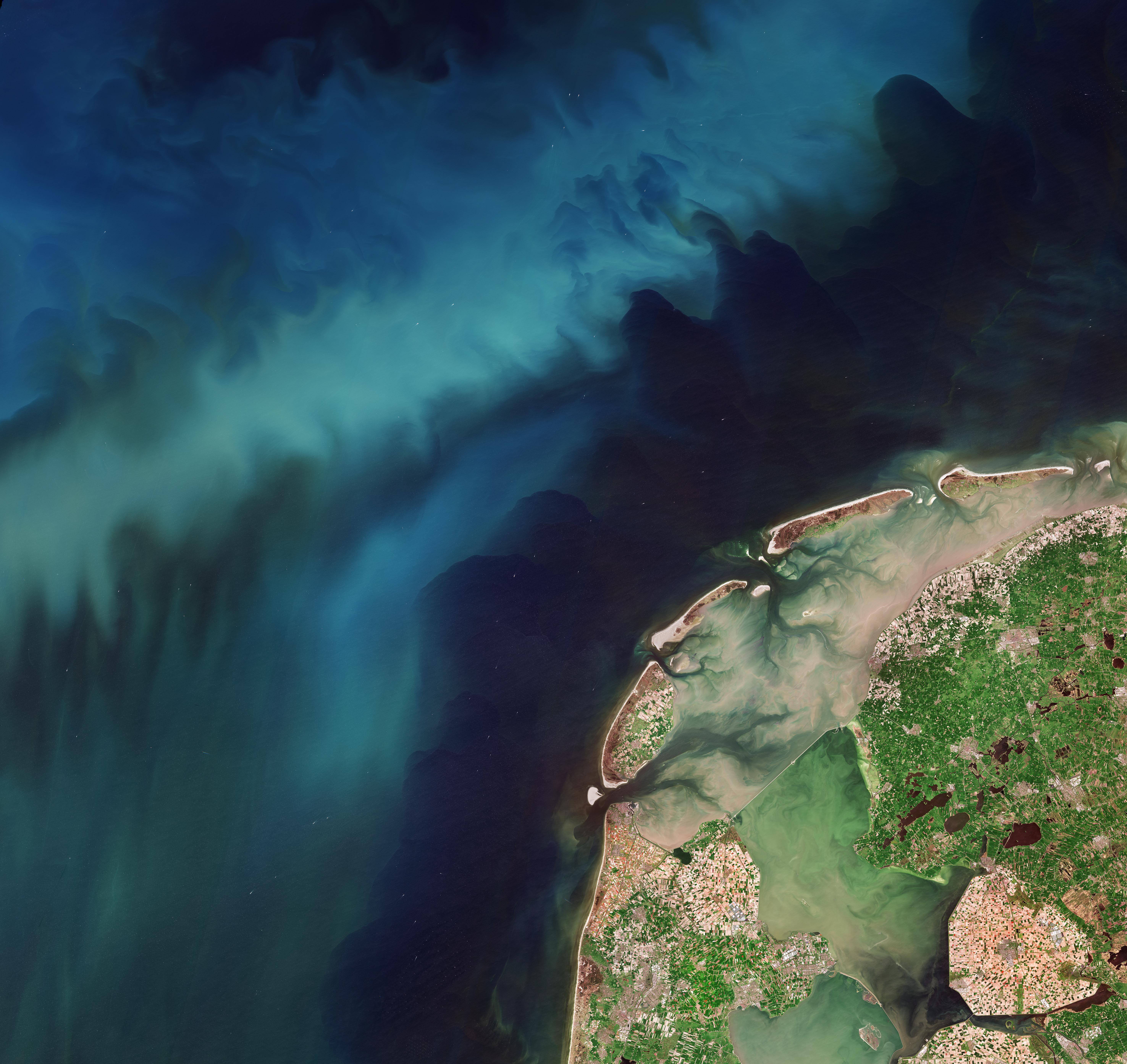
Captured by the Copernicus Sentinel-2 mission on 21 April 2026, this image shows a double bloom in the Netherlands: an array of vibrant colours in the tulip fields as well as the blue-greenish swirls of phytoplankton in the North Sea.
In the image we can see the northwestern tip of the Netherlands, made up by a complex system of islands, peninsulas and water bodies. The area pictured encompasses part of the Dutch provinces of Flevoland to the bottom right, North Holland to the west and Friesland to the north, with the low-lying archipelago of the West Frisian Islands along the coast and gradually curving toward the mainland.
This chain of islands is separated from the mainland by the narrow belt of shallow waters and tidal mud flats of the Wadden Sea, a saltwater inlet of the North Sea. The brown-coloured waters indicate a high sediment content, which contrasts with the darker waters of the outer sea. Two dams are visible as white lines across the internal waters creating two separate freshwater bodies: the larger IJsselmeer lake and the smaller Markermeer.


1 Comment
Image from this post, excerpt from post below the link:
[https://www.flickr.com/photos/europeanspaceagency/55250882498/](https://www.flickr.com/photos/europeanspaceagency/55250882498/)
Captured by the Copernicus Sentinel-2 mission on 21 April 2026, this image shows a double bloom in the Netherlands: an array of vibrant colours in the tulip fields as well as the blue-greenish swirls of phytoplankton in the North Sea.
In the image we can see the northwestern tip of the Netherlands, made up by a complex system of islands, peninsulas and water bodies. The area pictured encompasses part of the Dutch provinces of Flevoland to the bottom right, North Holland to the west and Friesland to the north, with the low-lying archipelago of the West Frisian Islands along the coast and gradually curving toward the mainland.
This chain of islands is separated from the mainland by the narrow belt of shallow waters and tidal mud flats of the Wadden Sea, a saltwater inlet of the North Sea. The brown-coloured waters indicate a high sediment content, which contrasts with the darker waters of the outer sea. Two dams are visible as white lines across the internal waters creating two separate freshwater bodies: the larger IJsselmeer lake and the smaller Markermeer.