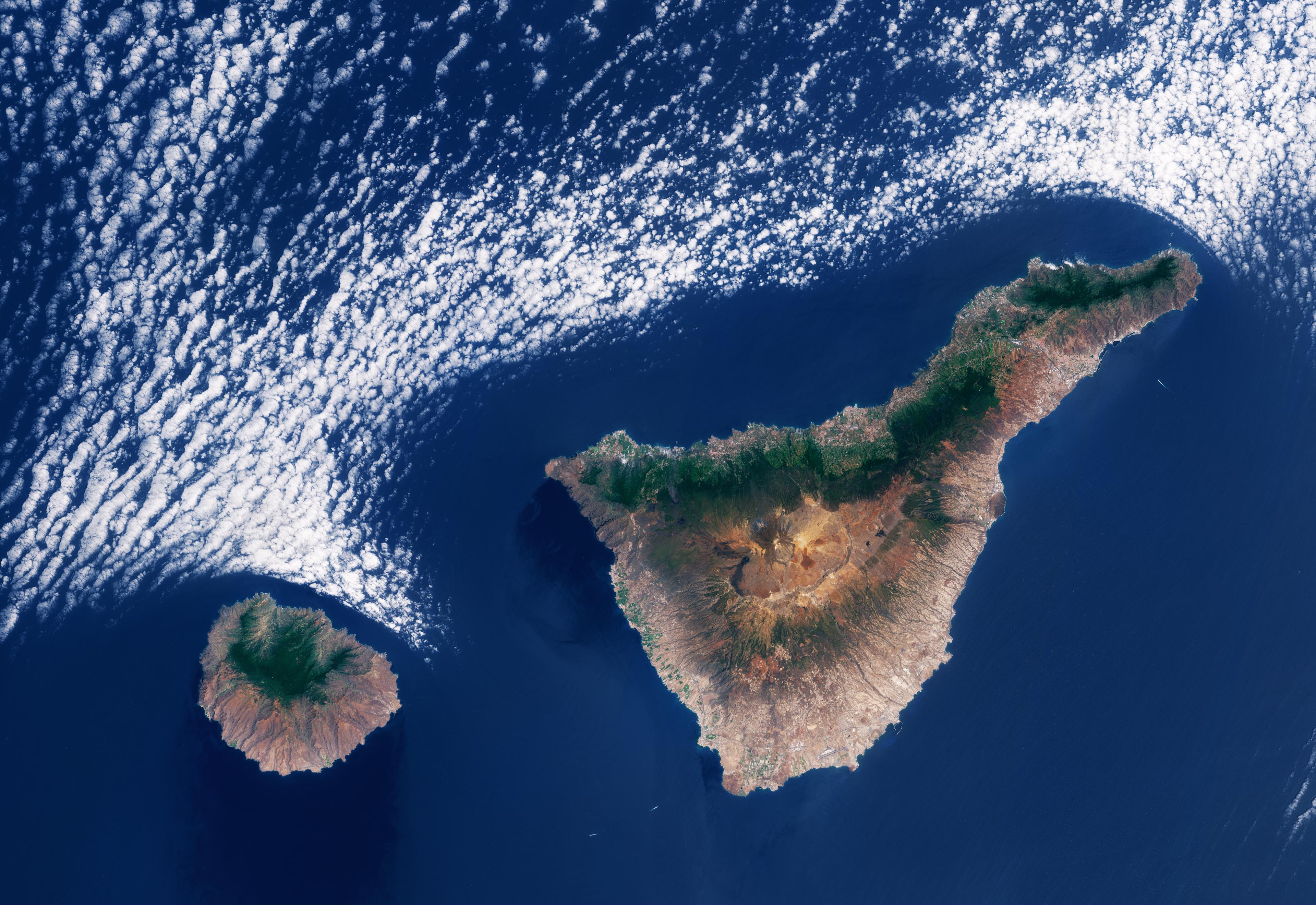
Weather and climate are heavily influenced by the trade winds blowing from the northeast for most of the year, bringing humidity and precipitation to the north of the island. This effect can be appreciated in the image through the sharp contrast between the generally greener north and the more arid southern part on both islands.
The interaction between the winds and the islands’ steep topography is also responsible for the cloud patterns that usually form over and around the archipelago. In this image, marine stratocumulus clouds can be seen closely following the northern coasts of the islands.
As the trade winds blow from the northeast, they push the cool, moist marine air towards the islands. Atmospheric conditions in the region trap the air at altitudes below 1500 m, forming the stratocumulus cover. When the droplets in the clouds come into contact with the warmer air over the land, they evaporate roughly following the outlines of the coasts.


1 Comment
Image from this post, excerpt from post below the link:
[https://www.esa.int/ESA_Multimedia/Images/2026/04/Earth_from_Space_Cloud_patterns_over_the_Canary_Islands](https://www.esa.int/ESA_Multimedia/Images/2026/04/Earth_from_Space_Cloud_patterns_over_the_Canary_Islands)
Weather and climate are heavily influenced by the trade winds blowing from the northeast for most of the year, bringing humidity and precipitation to the north of the island. This effect can be appreciated in the image through the sharp contrast between the generally greener north and the more arid southern part on both islands.
The interaction between the winds and the islands’ steep topography is also responsible for the cloud patterns that usually form over and around the archipelago. In this image, marine stratocumulus clouds can be seen closely following the northern coasts of the islands.
As the trade winds blow from the northeast, they push the cool, moist marine air towards the islands. Atmospheric conditions in the region trap the air at altitudes below 1500 m, forming the stratocumulus cover. When the droplets in the clouds come into contact with the warmer air over the land, they evaporate roughly following the outlines of the coasts.