
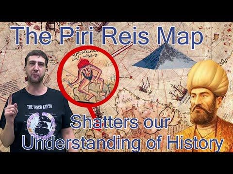
The Piri Reis Map is a 500-year-old enigma that challenges everything we think we know about ancient history. Based on even older source maps—possibly thousands of years old—it shows Antarctica’s coastline without ice, long before its official discovery in 1820.
How could this be possible?
Some believe it’s evidence of a forgotten Ice Age civilization—others point to the Atlanteans, the Tartarians, the Nacaals of Mu, ancient Chinese explorers, Annunaki, or even inner Earth dwellers. In this deep dive, I also explore the life of the Ottoman admiral Piri Reis, the map’s creator, and the mystery surrounding Columbus’s lost map and Magellan’s suspicious foreknowledge of the strait that now bears his name.
This isn’t just a map. It’s a crack in the official timeline.
by TheWhiteRabbit4090