
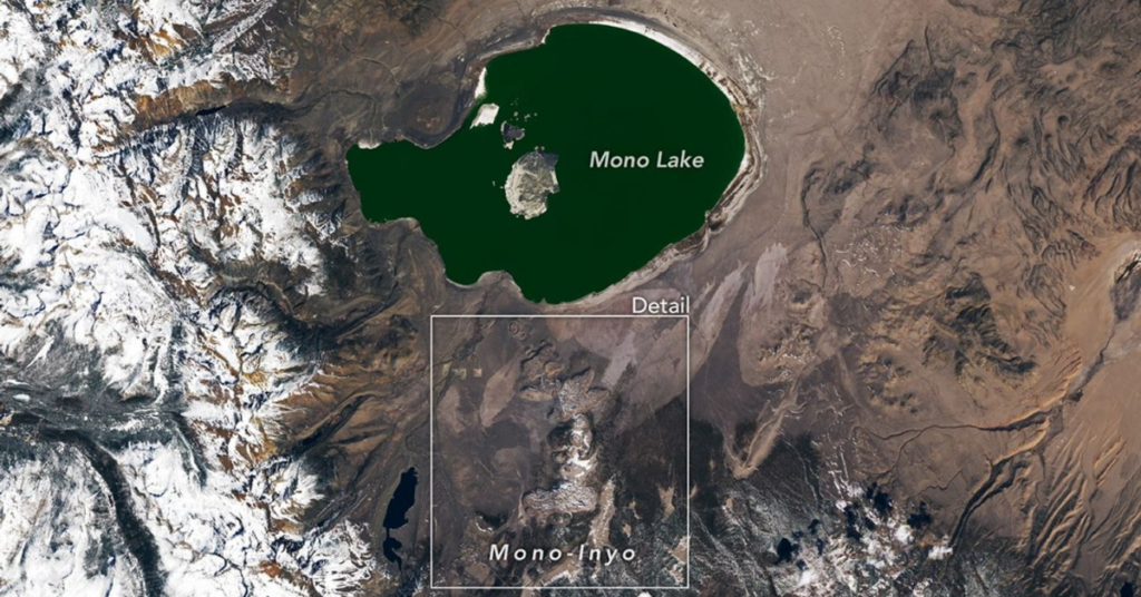
NASA just pointed a satellite at the eastern Sierra Nevada and the images reveal a volcanic landscape that most Californians have no idea exists.
The agency’s Earth Observatory released imagery captured on March 29, 2026, by the Landsat 9 satellite showing the string of craters, cones and calderas that stretch between Mono Lake and Mammoth Mountain. The images look more like something from Mars than from a region best known for skiing and trout fishing.
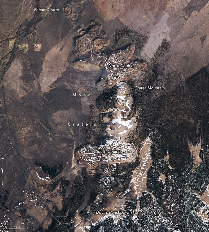
The most visible features are the Mono-Inyo Craters, a chain of about three dozen lava domes, lava flows and tephra rings that formed within the past 10,000 years. Panum Crater near Mono Lake, which formed roughly 700 years ago, shows a clear concentric-circle pattern from space where a lava dome of pumice and obsidian built up inside a ring of volcanic debris.
Mammoth Mountain itself is made up of at least 25 overlapping lava domes. Its last magmatic eruptions occurred about 57,000 years ago, but the mountain is far from dormant. A magma intrusion in 1989 triggered earthquakes and volcanic gas emissions that continue today. Carbon dioxide venting from the mountain has killed trees in the surrounding forest, and the USGS monitors those emissions year-round.
The largest feature in the images is the Long Valley Caldera, a massive oval depression measuring 10 by 20 miles that formed 760,000 years ago during a six-day eruption that ejected 150 cubic miles of material. That is roughly 20 times the volume produced by the largest eruption on earth in the 20th century.
The area continues to draw research interest from geologists and planetary scientists studying how volcanic processes shape landscapes both on Earth and elsewhere in the solar system.