

I've been researching why America's nuclear weapons labs were built where they were. The geology underneath them is not coincidental. Why isn't anyone talking about it?
I host a horror and true crime podcast called Fear and Wine, and I've been deep in research for an upcoming episode. I want to share something I stumbled into that I genuinely cannot stop thinking about. I'm not a geologist or a physicist, but I can read primary sources, and what I'm finding in peer-reviewed geology literature and declassified military engineering documents is making the hair on the back of my neck stand up.
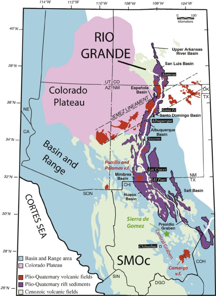
Here's the short version: every major nuclear weapons and aerospace intelligence facility in the United States sits on top of a geological rift system. And that may not be an accident. Click the image above for the full story. Sources in comments
by KDubbs0010110
2 Comments
* USGS Quaternary Fault Database (Pajarito fault, Sandia-Rincon fault): [https://www.usgs.gov/programs/earthquake-hazards/faults](https://www.usgs.gov/programs/earthquake-hazards/faults)
* New Mexico Bureau of Geology, Pajarito Fault System: [https://geoinfo.nmt.edu](https://geoinfo.nmt.edu)
* East Continent Rift Basin: Drahovzal et al. 1992, Kentucky Geological Survey Information Circular 3: [https://uky.edu/KGS](https://uky.edu/KGS)
* Project ELF declassified engineering documentation: available via DTIC at [https://dtic.mil](https://dtic.mil)
* Piezoelectric effects in fault zones: Journal of Geophysical Research
* FCC license search (WQXY316, WQXY300): [https://www.fcc.gov/licensing/database/search](https://www.fcc.gov/licensing/database/search)
* USGS aeromagnetic survey data: [https://mrdata.usgs.gov](https://mrdata.usgs.gov)
* Midcontinent Rift System: USGS Publications Warehouse at [https://pubs.usgs.gov](https://pubs.usgs.gov)
I took geology in college. Got an A-
I have no clue what you’re talking about.
And no I’m not reading all that.