

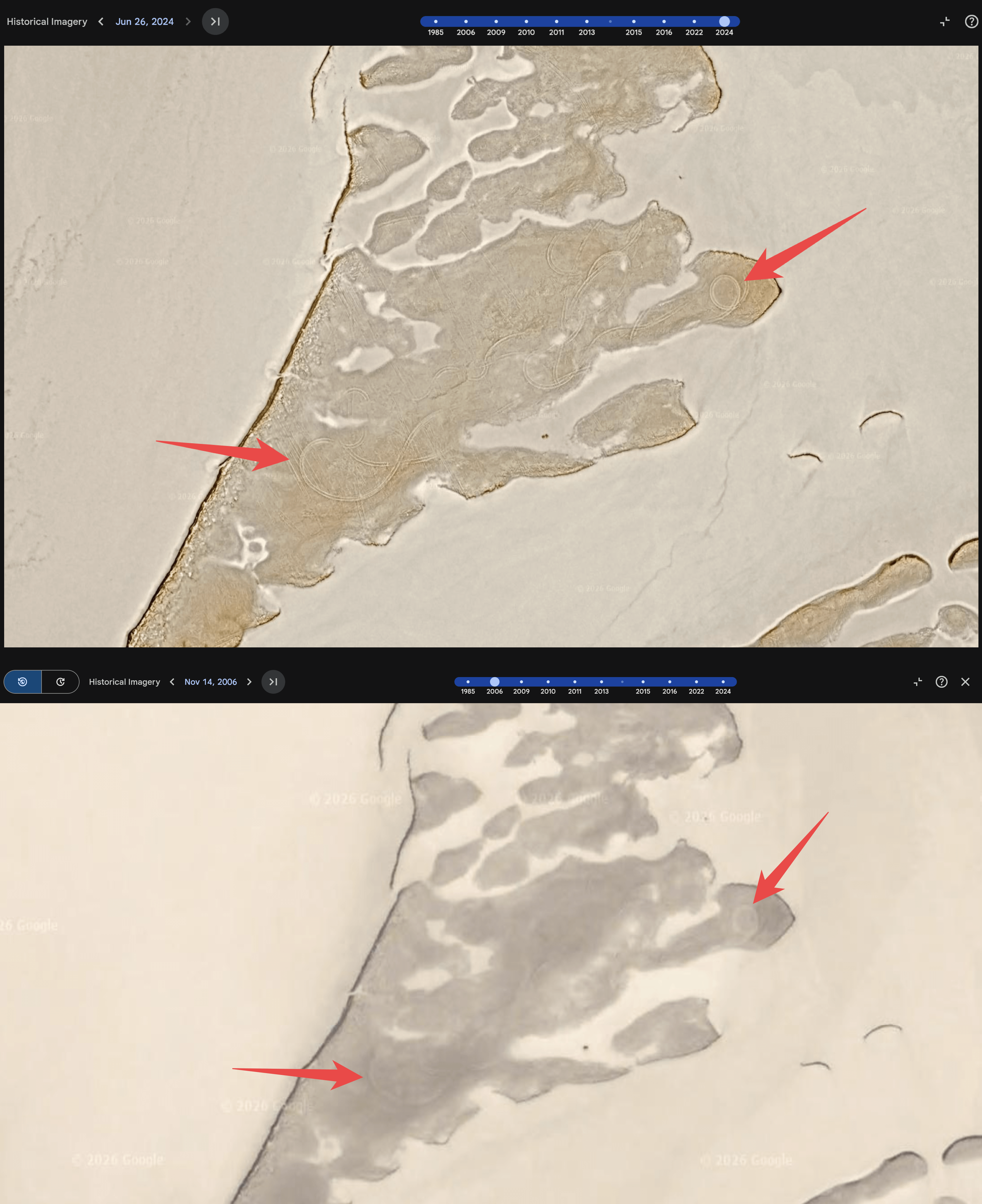
After watching the S4 Bob Lazar documentary, I got curious and decided to go on Google Earth to check out those tire tracks they showed at Papoose Lake.
I started scrolling through the historical imagery for those exact coordinates, and I noticed something interesting. The exact same tire tracks you see in the recent satellite views show up in every single year all the way back to 2006.
I'm genuinely just curious—why are these still here? I would have expected tire tracks to be completely washed away, blown over by wind, or covered up by the elements at this point. It’s been over 20 years.
They might actually be even older than 2006, to be honest. It's just that any satellite imagery from before then gets way too blurry to see anything clearly, so 2006 is the furthest back I can confirm.
Does anyone know how desert environments or dry lake beds work with this kind of stuff? Is it normal for ground scars to just freeze in time for decades without washing away?
Coordinates:
37°06'48.88"N 115°50'55.83"W
by Pinktoe_
7 Comments
After watching the S4 Bob Lazar documentary, I got curious and decided to go on Google Earth to check out those tire tracks they showed at Papoose Lake.
I started scrolling through the historical imagery for those exact coordinates, and I noticed something interesting. The exact same tire tracks you see in the recent satellite views show up in every single year all the way back to 2006.
I’m genuinely just curious—why are these still here? I would have expected tire tracks to be completely washed away, blown over by wind, or covered up by the elements at this point. It’s been over 20 years.
They might actually be even older than 2006, to be honest. It’s just that any satellite imagery from before then gets way too blurry to see anything clearly, so 2006 is the furthest back I can confirm.
Does anyone know how desert environments or dry lake beds work with this kind of stuff? Is it normal for ground scars to just freeze in time for decades without washing away?
Coordinates:
37°06’48.88″N 115°50’55.83″W
Iv though the same thing about the nazca lines, but apparently its normal
I think that’s just South America
Tire tracks next to a playa (dry lake bed) last a lonnnnnng time.
Example: much further north in Nevada in the Black Rock Desert you can *still* see pioneer wagon wheel tracks.
Incidentally, the extremely delicate desert environments in the American Southwest deserve to be admired but not messed with. That cactus or Joshua tree someone messes-up with their ATV or souvenir-picking is probably hundreds of years old for the cacti and over a thousand years old for the tree.
There are cow paths at my parents place where they used to herd them back to the barn in the 1920s.
Because they’re probably shuttling people back and forth out there everyday.
Probably because the most we can do with tire tracks is look at them and go *egads batman! The military discovered how to drive a jeep!*
They’re not in a rush to coverup that time Private Johansson decided to get drunk and do some donuts.