

Sometimes to understand the weather, you have to fly straight into it.
In hangar 8 at the 5 Wing Goose Bay base in central Labrador, a team is getting a NASA aircraft ready to do that — head directly into the atmosphere’s most unpredictable regions.
It’s a major research mission led by NASA, called the North American Upstream Feature-Resolving and Tropopause Uncertainty Reconnaissance Experiment (or the welcomed abbreviation NURTURE for anyone who’s not a weather scientist).
Over the course of four to six weeks, a couple of teams — made up mainly of scientists, along with a couple of pilots and aircraft maintenance personnel — are chasing storms, before they’re even born, where the atmosphere is largely unmeasured high above the Arctic.
The goal is to improve winter weather forecasting. But the tricky part is they’re looking for something they can’t see.
I got to talk to members of one of the NASA teams before they took off for the skies, on the very plane they’d be flying.
This was a dream come true. NASA is so iconic and here the agency was in our province doing weather research to help improve the forecast models I use everyday.
What’s a spinning pocket of cold air?
You’ve likely heard a lot about the polar vortex recently. It’s around every winter — an area of frigid air sitting over the Earth’s polar regions. It’s caused by the big temperature difference between cold air over the Arctic and warm air in the tropics which then creates a jet stream trapping the cold air at the North and South Poles.
Embedded within the larger polar vortex are smaller spinning pockets of cold air called tropospheric polar vortices, (or TPVs, for anyone, again, who likes abbreviations and who’s not a weather scientist).
If you stepped outside and looked up while one passed over head, you wouldn’t notice anything unusual. Often, there are no clouds. No dramatic satellite image. No obvious sign they’re there.
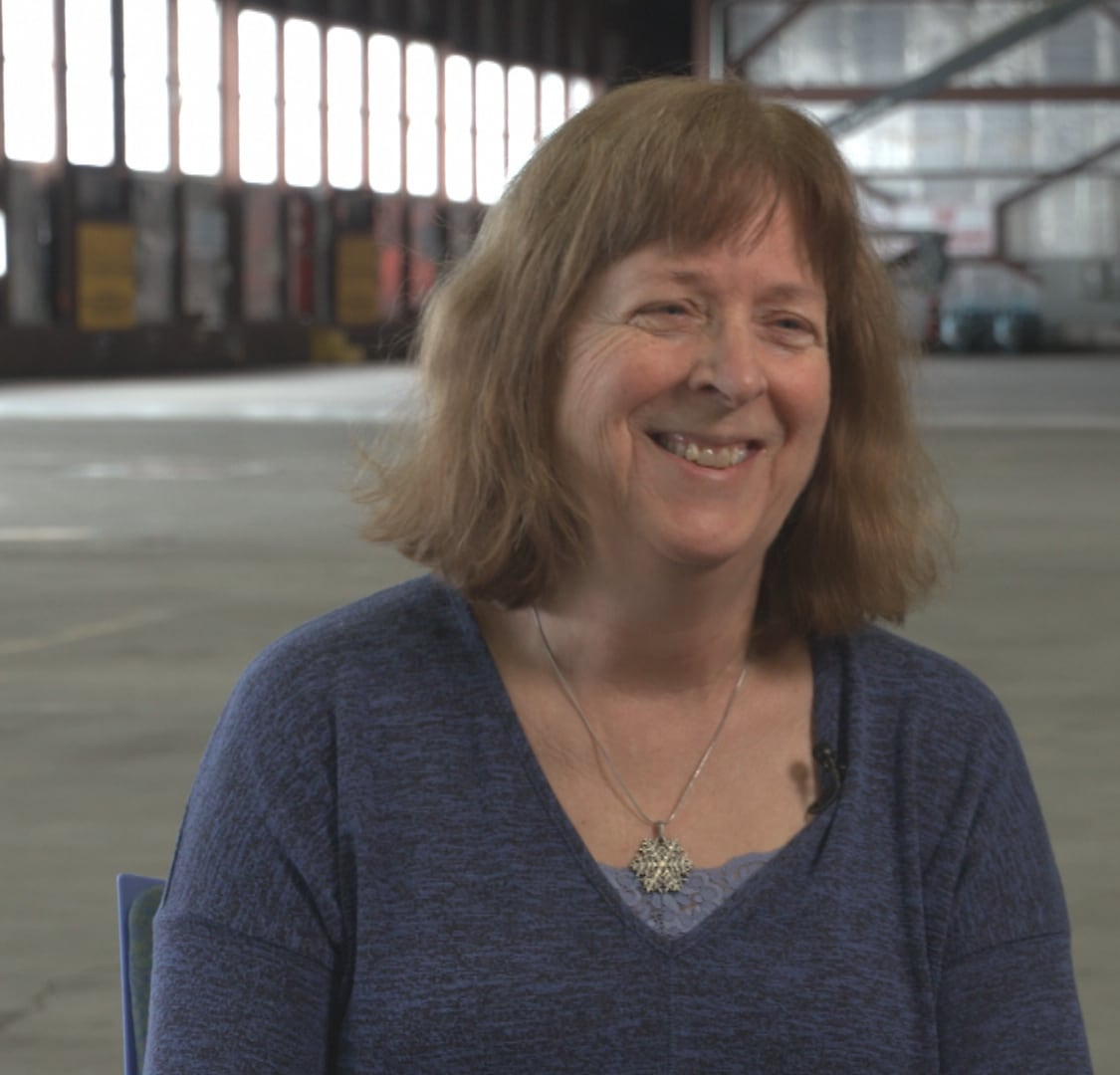 Lynn McMurdie is a research professor from the University of Washington and part of the NASA team that was in Labrador. (Mark Cumby/CBC)
But these small atmospheric features can shape some of the most powerful winter storms we experience.
“They can be involved with helping develop individual storms. The ones that do produce the clouds and precipitation and snowfall that you experience,” said Lynn McMurdie, a research professor from the University of Washington and part of the NASA team on the ground, and in the air, in Labrador.
In other words, what happens thousands of kilometres north of Newfoundland and Labrador can determine whether we get flurries or a major winter storm.
A forecast is just that
Modern weather models are powerful. They simulate the atmosphere, analyzing millions of data points to predict what will happen days into the future.
But there’s a catch: they’re only as good as the data they’re fed, and while there are gaps in the data all over the world, that’s especially true in Canada.
There’s a few reasons: vast stretches of ocean, sparse weather stations, limited radar coverage.
WATCH | Researchers are flying high in the atmosphere to try to improve winter forecasts: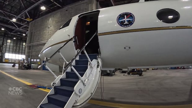
Step aboard a NASA aircraft doing weather research in Labrador
NASA researchers took off from Happy Valley-Goose Bay to chase storms in the skies before they form. As CBC meteorologist Ashley Brauweiler explains, their research is aimed at improving winter weather forecasting.
“We think we know where [the TPVs] are with our numerical models,” McMurdie said. “But we don’t really know where they are.”
That uncertainty becomes critical three or four days down the line, when forecast models begin to diverge. One may predict a major snowstorm tracking toward Atlantic Canada, while another may show very little at all.
Often, the difference traces back to what’s happening upstream, high over the Arctic, where observations are limited.
That’s where NURTURE and the NASA team come in.
Why fly to the weather?
To study these TPVs properly, scientists need to go to the source.
“You gotta go where the interesting stuff is,” said McMurdie.
The team flies in a modified Gulfstream III research jet, which, instead of seats, is equipped with advanced instruments to measure moisture near the jet stream, and radar to measure clouds and precipitation and even monitor ozone levels.
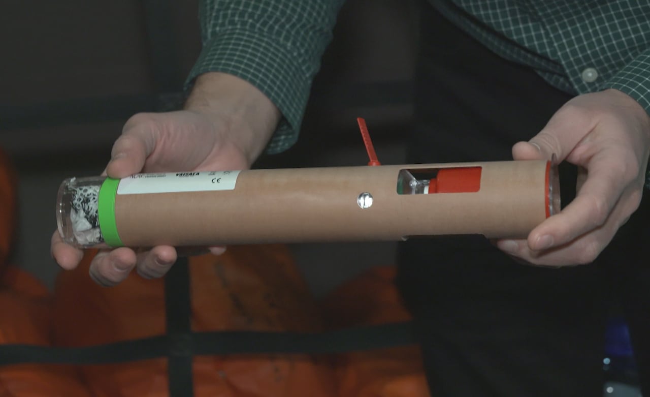 A dropsonde is a small instrument that the NASA team uses. When one falls from the aircraft to the surface, it will transmit detailed vertical profiles of the atmosphere. (Mark Cumby/CBC)
The scientists also release dropsondes — small instruments that fall from the aircraft to the surface, transmitting detailed vertical profiles of the atmosphere as they fall — all in a search for answers in the layers of the atmosphere we rarely measure directly.
Moisture matters
During one recent flight, graduate student Valeria Garcia watched the data, which was available in real time as a dropsonde fell through the core of a TPV.
“We could see the moisture drop when we were in the core,” she said, “and the model is overpredicting the moisture.”
A little too much moisture in the computer simulation may sound like a small detail, but in atmospheric science, moisture influences temperature, temperature influences stability, and stability determines how strong these vortices become, and how they interact with the jet stream.
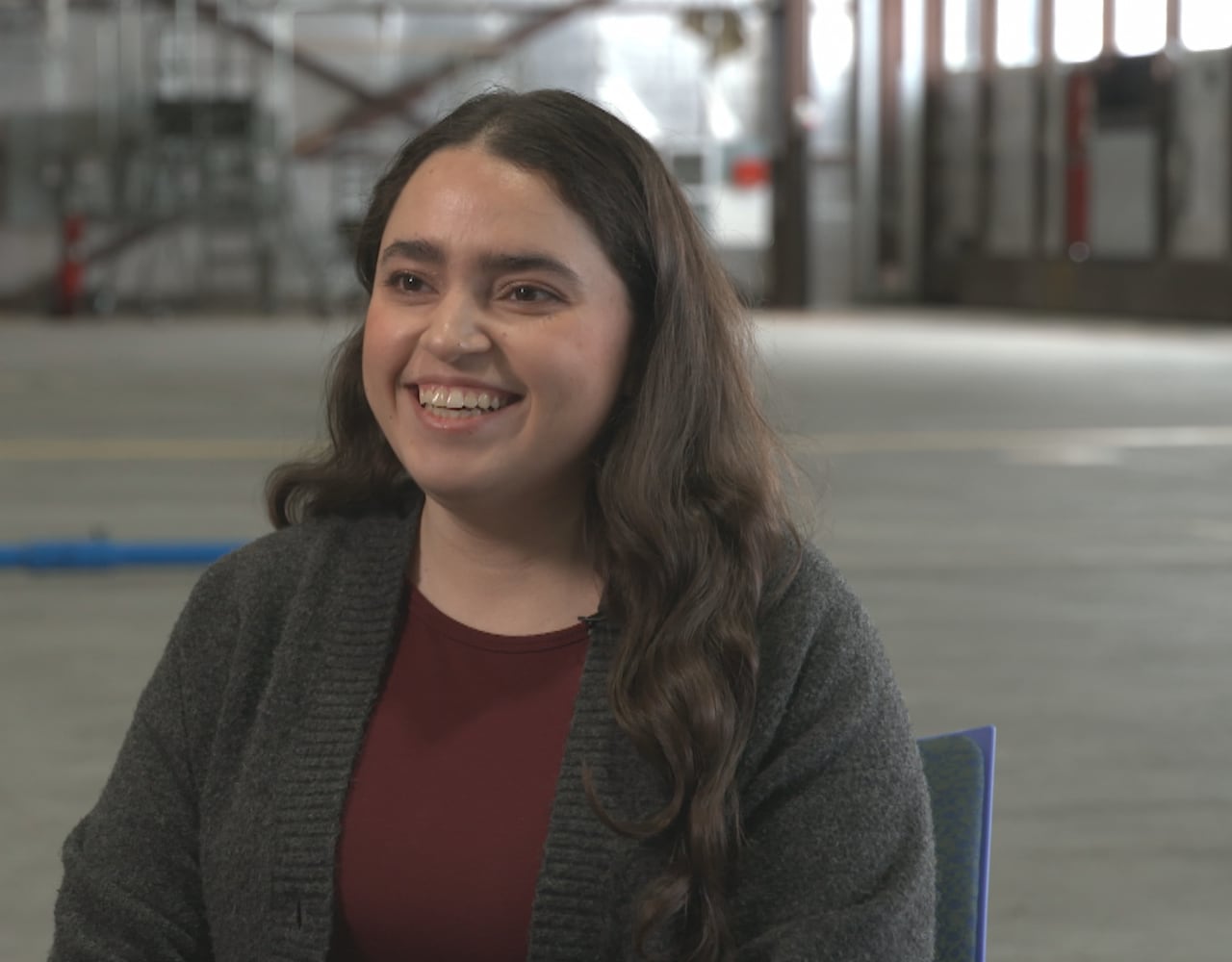 Valeria Garcia is a graduate student at the University of Washington. (Mark Cumby/CBC)
When the models overpredict the moisture, it means that everywhere is warmer than it actually is, and may weaken a vortex that, in reality, is strong.
That miscalculation can have big implications in the forecast, which could ultimately affect whether — and where — a winter storm develops.
Garcia described it as a “trickle-down effect.” That small error upstream can grow into a major forecast difference days later.
There’s a long-term research goal behind NURTURE: better understanding how these vortices interact with the jet stream and how they evolve over time.
But there’s also an immediate benefit.
Some of the dropsonde data collected over the Arctic is fed directly into forecast models in real time through a process known as data assimilation.
“You really need to start your weather prediction cycle with the most accurate state of the atmosphere,” said McMurdie.
If the model’s starting point is wrong, it drifts.
If it’s right, confidence in the forecast improves.
That means these research flights taking off from Happy Valley-Goose Bay today could influence the accuracy of the forecast tomorrow.
Why Happy Valley-Goose Bay is a fit for NASA
The small town in central Labrador is perfectly positioned for this research. Many tropospheric polar vortices (TVPs) form farther north, then drift southward over Labrador and the North Atlantic.
From here, the aircraft can reach those systems efficiently and release dropsondes safely over open water.
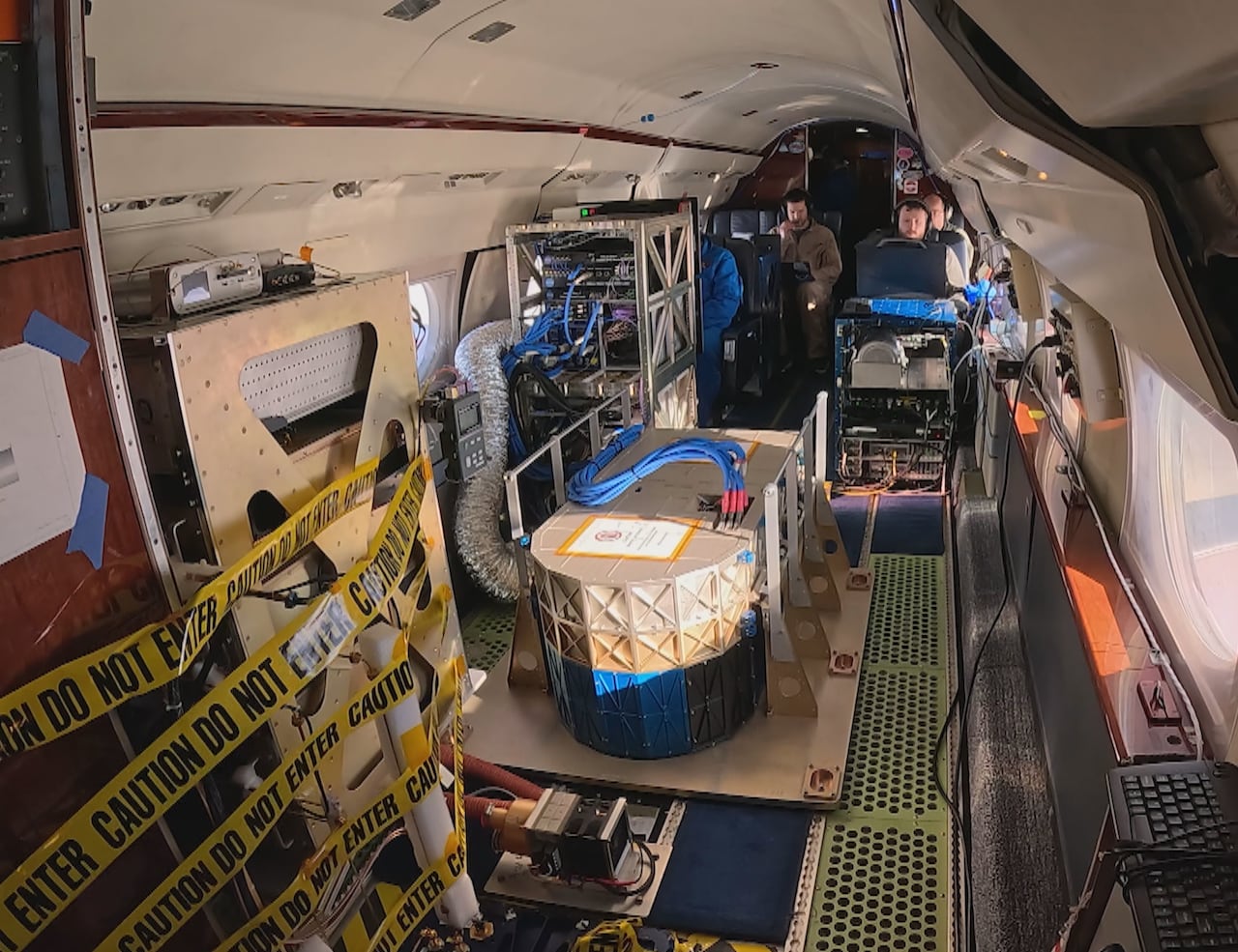 A GoPro image of inside the plane that NASA team members fly. (CBC)
It provides the perfect opportunity to observe the upstream drivers of winter weather from up close.
Some vortices fizzle. Others turn into powerful storms — the kind that bury us here in Newfoundland and Labrador, or send Arctic air deep into the United States.
By studying the storms upstream, before they intensify, NURTURE aims to reduce uncertainty and improve winter storm prediction across North America and Europe, which will help meteorologists issue earlier warnings and potentially save lives.
Download our free CBC News app to sign up for push alerts for CBC Newfoundland and Labrador. Sign up for our daily headlines newsletter here. Click here to visit our landing page.