

Update on the Great Circle analysis for anyone following this.
The biggest objection to Part 1 was geography — the circle passes through the Nile Valley and the Andes, so of course you find sites there. Fair point.
So we tested it. Using the Pleiades academic database, we separated ancient monuments (temples, pyramids, sanctuaries) from ancient settlements (villages, farms, towns). Same geography. Same time period. Same methodology.
Monuments: 5.05× enrichment, Z = 11.83. Settlements: 0.78×, Z = −0.95.
The divergence gets sharper the closer you look — strongest at 10 km, weakens with distance. That's the signature of a genuine linear feature, not a statistical artifact.
We also expanded to six independent databases: UK volunteers, academic classicists, crowd-sourced mappers, Peru's national government, Wikimedia editors, and physical radiocarbon measurements. All show the same pattern.
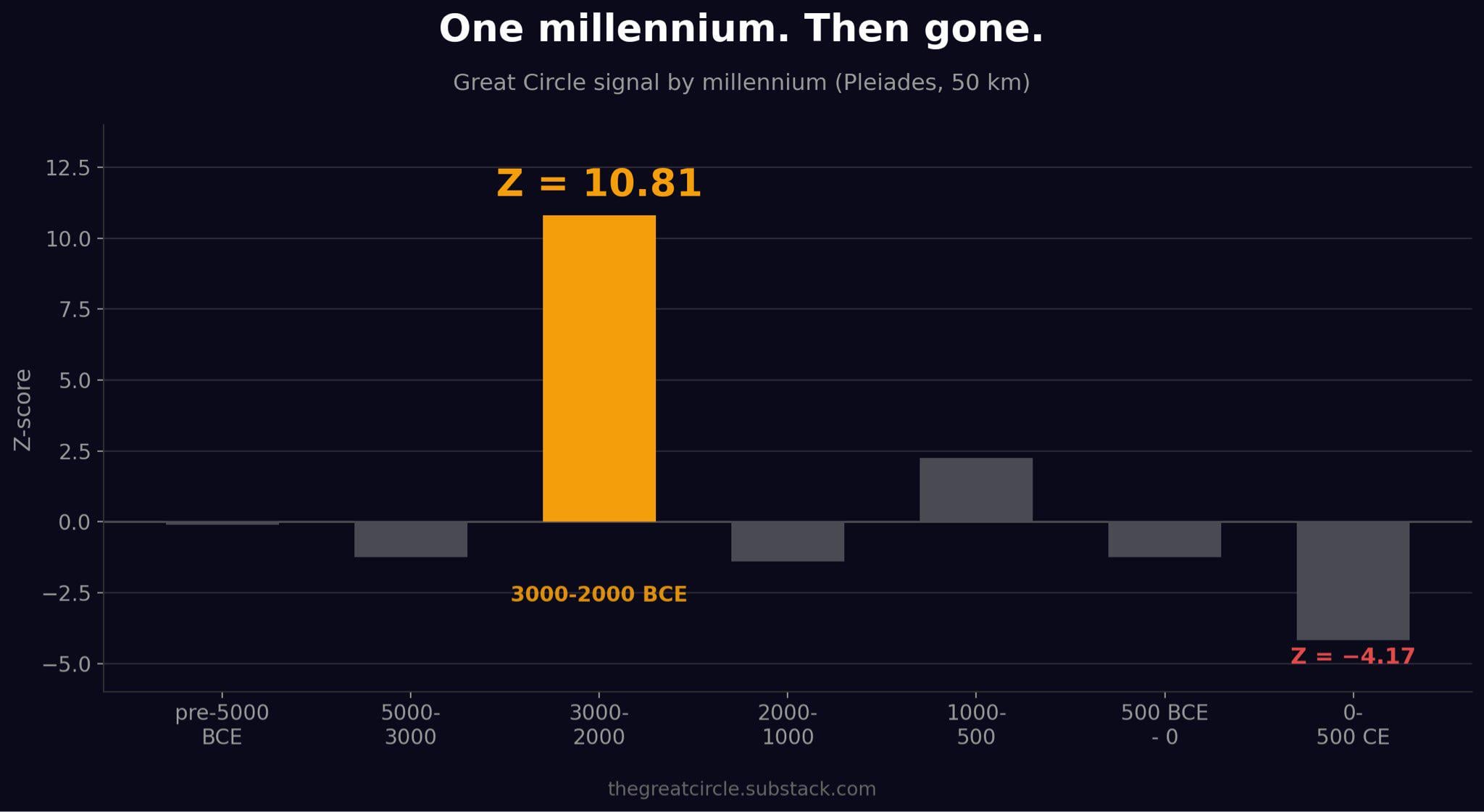
The temporal spike is the part I can't explain. The signal exists in one millennium, 3000-2000 BCE. It is absent before and after. The Nile Valley was fertile in 5000 BCE. It was fertile in 1000 BCE. But only the 3000-2000 BCE construction clusters on this line.
Full analysis: thegreatcircle.substack.com/p/the-settlement-test
Interactive globe: thegreatcircle.earth
All code and data open source.
by tractorboynyc