

New research has suggested that UFOs could be clustering around underwater canyons off the US coastline, raising fresh questions about whether mysterious craft could be operating beneath the ocean.
An analysis of more than 80,000 reports found concentrated clusters of sightings near steep submarine canyon systems, particularly along the West Coast.
The findings stem from an independent study testing the so-called ‘cryptoterrestrial hypothesis,’ which proposes that unidentified aerial phenomena could originate from hidden non-human intelligence on Earth rather than distant planets.
Using publicly available UFO sighting data and detailed ocean depth maps, the report identified correlations between reported sightings and deep underwater terrain features.
The analysis also uncovered a striking geographical anomaly, with clustering patterns appearing on the West Coast but not on the East or Gulf coasts.
Three regions, La Jolla, Mugu Canyon, and Monterey Canyon, showed unusually high concentrations of sightings compared with population-based expectations.
The report suggested sightings could occur in temporal bursts rather than being evenly distributed over time.
While the findings stop short of proving any underwater origin, they add data-driven support to growing scientific interest in unexplained objects moving between air and sea.
Using publicly available UFO sighting data and detailed ocean depth maps, the report identified correlations between reported sightings and deep underwater terrain features
The study was conducted by Antoni Wędzikowski, a Warsaw-based lawyer and independent researcher who analyzed 80,000 UFO reports from the nonprofit National UFO Reporting Center (NUFORC) and compared them with bathymetric data from the National Oceanic and Atmospheric Administration.
The cryptoterrestrial hypothesis has gained renewed attention in recent years due to several high-profile military encounters involving objects that appeared to transition between air and sea.
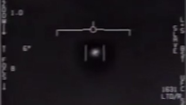
One of the most famous incidents occurred in November 2004, when US Navy pilots aboard the USS Nimitz detected multiple unidentified objects descending from 80,000 feet in less than a second during training exercises off Southern California.
Cmdr. David Fravor later described seeing a white, capsule-shaped craft, dubbed the ‘Tic Tac,’ that appeared to intelligently respond to the pilots’ maneuvers.
Wędzikowski’s study found that UFO sightings near submarine canyons did not occur randomly but tended to cluster in bursts over short periods.
‘First, the analysis did find a statistically significant spatial association between submarine canyon features and UAP report density along the US West Coast,’ he said.
‘These are not trivial numbers. The association also correctly predicted 4 out of 5 top hotspot cells.’
‘But the second surprise was equally important: the effect is absent on the East and Gulf Coasts. It is not a universal pattern. It concentrates in specific West Coast regions, primarily Puget Sound and the San Diego canyon system, and does not generalize across the full US coastline.’
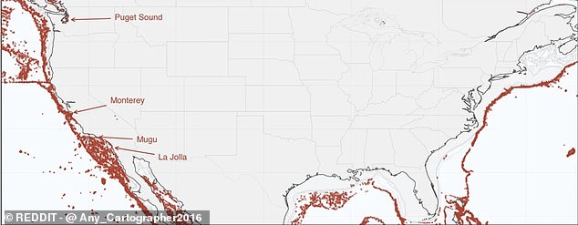
Three regions, La Jolla, Mugu Canyon, and Monterey Canyon, showed unusually high concentrations of UFO sightings compared with population-based expectations
Each of the three major clusters of sightings was associated with deep underwater topography.
In these areas, the number of sightings far exceeded what would be expected based on population distribution alone.
La Jolla recorded 820 sightings, compared with an expected baseline of just 55, according to the researcher’s model.
However, Wędzikowski cautioned that the results do not prove that unidentified craft are emerging from the ocean.
He acknowledged that social factors could explain some clustering, such as increased reports following widely publicized sightings.
Still, he argued that the geographic patterns warrant further investigation using independent datasets and additional methods, including sonar analysis.
By comparing sonar records with UAP sighting clusters, he said it could help determine whether unexplained underwater activity coincides with reported hotspots.
Wędzikowski now has plans to publish his methodology and data for peer review and urged other researchers to replicate the findings.
Using the AI tool Claude Code, he corrected for population density and other confounding variables, then examined whether sightings clustered near steep underwater terrain.
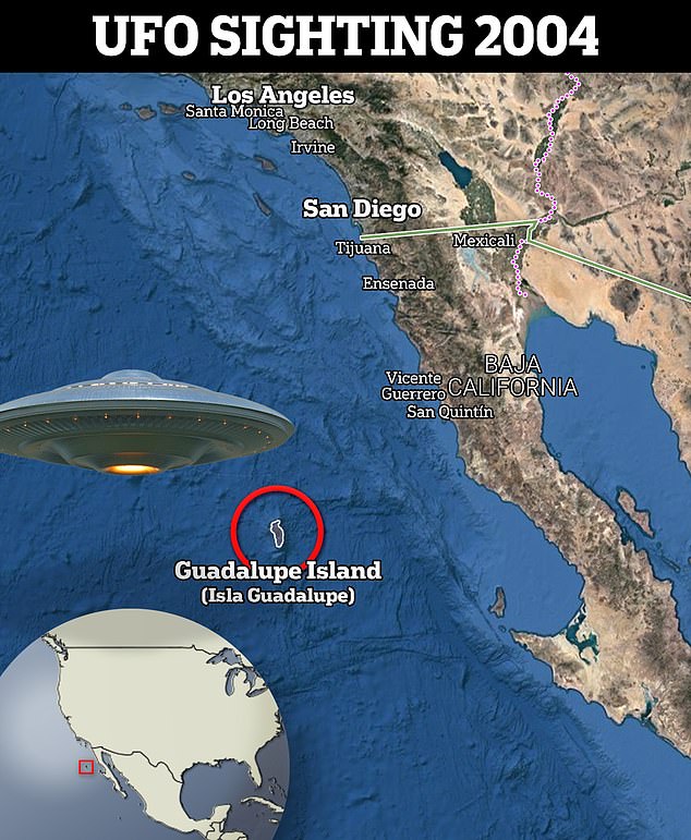
In November 2004, Navy pilots aboard the USS Nimitz were conducting training exercises off the coast of Southern California when radar detected multiple unidentified aerial objects
‘The specific hypothesis, that UAP report density might correlate with submarine canyon features along the coastline, came from noticing that several well-known hotspot areas sit above unusually steep underwater topography,’ Wędzikowski told Daily Mail.
‘Rather than treat that as evidence of anything, I wanted to test it properly: population-controlled, with confound checks, temporal replication, and clear documentation of what survives scrutiny and what doesn’t.’
Wędzikowski said he was surprised that no one had previously conducted such a systematic geospatial analysis of the publicly available data.
‘I’ve followed the UAP topic for years, and what consistently frustrated me was the gap between the data that actually exists and the way the subject is typically discussed, which tends to rely on individual case narratives or speculation rather than systematic analysis,’ he explained.
‘There are tens of thousands of geolocated sighting reports in public databases like NUFORC. The data has been sitting in public databases for decades. The tools to test it are standard geospatial statistics. The surprising thing is not the result. It’s that nobody looked.’