
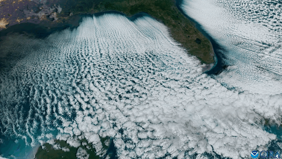
Better known as “cloud streets,” these formations can develop when cold, dry air flows over relatively warmer water. As the air absorbs heat and moisture from below, rows of long, parallel lines of cumulus clouds form, usually aligned with the wind direction.
In this satellite imagery, a gap of clear skies is visible between the coastline and where the cloud streets begin. That’s due to the time and distance it takes the cold air to pick up the heat and moisture from the water to form clouds.
Credit: NOAA/GOES-19
by Busy_Yesterday9455
8 Comments
Neat 📸
Is that actually real footage?!? That’s insane!
Saturday was strange here in Florida. Super cloudy all day, then late afternoon the clouds booked it out of here. Then came the coldest 3 mornings of my life (mid-thirties!- my age).. kinda cool
Ah there they go, off to Ireland and the UK.
I would like it more if it weren’t cropped and panning without a clock show that this is gif repeating over and over.
Someone explain how this happens please
It seems to be pulsating
are there images of the whole USA/east at this stage?