
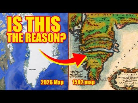
We can map the geography of mars perfectly. Yet Greenland is a featureless country covered in ice? Something doesn’t add up here. Between 1500-1700’s maps and now.
by atenne10
We can map the geography of mars perfectly. Yet Greenland is a featureless country covered in ice? Something doesn’t add up here. Between 1500-1700’s maps and now.
by atenne10
3 Comments
WOAH! You are telling me that an almost 500 year old map is highly inaccurate and that our satellites can capture an accurate image of what the landmass actually looks like? I’m baffled!
You can’t judge the state of cartography based on Google Maps or other GIS systems. We know very well what lies beneath the Greenland ice cap. That 1592 map is simply wrong.
https://preview.redd.it/6u22ewxs08hg1.png?width=1045&format=png&auto=webp&s=1c939871a9bc0ca029bf07f15833ab51d1501190
Well, the main reason is that they have bankrupted themselves with endless military actions around the world.