

The European Space Agency’s (ESA) brand-new Copernicus Sentinel-1D satellite launched into space aboard the Ariane 6 launcher from Europe’s Spaceport in French Guiana. ESA has shared the satellite’s first high-resolution images, which are spectacular examples of the power of radar-based imaging systems.
The Copernicus Sentinel-1D has a 12-meter (39-foot) synthetic aperture radar (SAR) instrument that maps the Earth’s surface in exceptional detail. Once in orbit, the satellite’s first targets on November 6, seen throughout this article, were the Antarctic Peninsula, Tierra del Fuego, and the Thwaites Glacier. Six hours later, Sentinel-1D captured images of Bremen, Germany, in the early morning hours of November 7.
The data was then transmitted, or “downlinked,” in scientific parlance, from the satellite in orbit to ground operations on Earth in Italy. Nearly as impressive as the images themselves is the speed with which the satellite launched, reached orbit, and began scientific operations. Within 50 hours of careening into space aboard a rocket, the satellite was sending images to the team. This is, per ESA, likely the shortest time from launch to delivery ever for a radar-based Earth observation satellite.
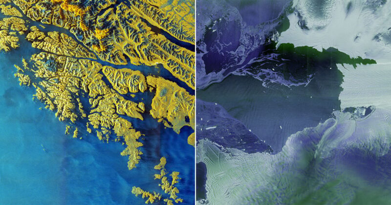
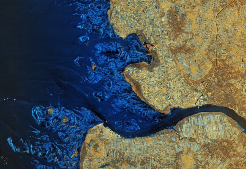
 Tierra del Fuego by Sentinel-1D | ESA
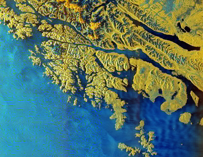
 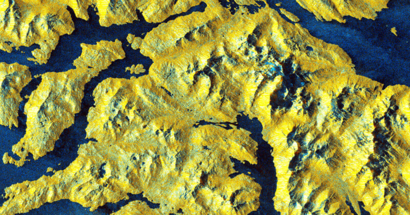 100% crop
Per Nuno Miranda, ESA’s Sentinel-1 Mission Manager, these first images from Sentinel-1D are of “unprecedented quality.”
“These images have been downlinked and processed within an exceptionally short timeframe. Some of us remember that when Sentinel-1B was launched, it delivered its first radar images within two hours of activation. Sentinel-1D achieved this in an even faster time, setting what we believe is a new record for space radar. This remarkable performance reflects the dedication and exceptional preparation of all the teams involved,” Miranda continues.
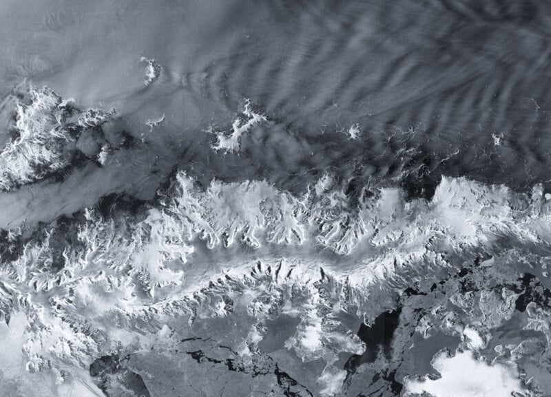 Antarctic Peninsula by Sentinel-1D | ESA
 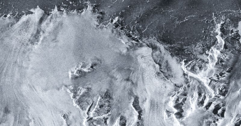 100% crop
What’s particularly interesting about the Sentinel-1D’s imaging system is how it works. The camera emits microwaves toward Earth, and then they reflect off its surface back to the satellite. Depending on precisely how they bounce back, like how quickly, the data reveals exceptional surface detail. There is no visible-light camera aboard the satellite.
Radar has distinct advantages for satellite imagery, not the least of which is that it can penetrate clouds and precipitation and work equally well at night as during the day.
The radar camera captures different “colors” by combining various types of radar waves. In one particularly striking shot of Tierra del Fuego off the southern tip of the South American continent, the land is yellow and snowy peaks and the ocean are shades of blue. Other images are black-and-white or employ vastly different hues.
 Elbe River delta by Sentinel-1D | ESA
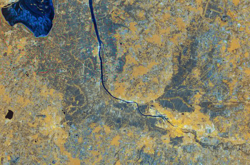 Bremen by Sentinel-1D | ESA
“This is a great achievement and I am so pleased to see these results from Sentinel-1D,” says Simonetta Cheli, Director of ESA’s Earth Observation Programs. “It really places the data we receive from our innovative missions in the spotlight — it is data that we as a society rely upon as we continue to discuss and take action on climate change, and also data that we need in applications for understanding and studying our planet.”
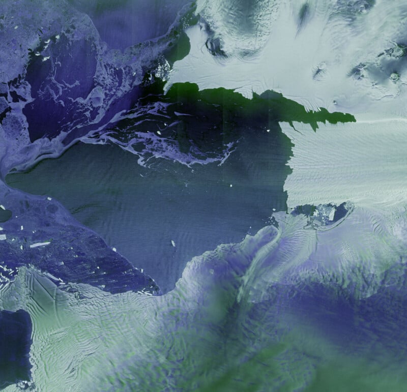 Thwaites and Pine Island glaciers by Sentinel-1D | ESA
 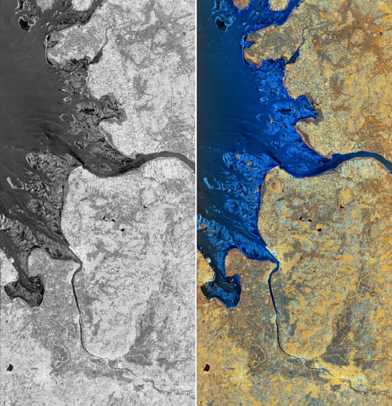 Bremen, Germany | ESA
“Unveiling the first images from Sentinel-1D is an incredibly emotional milestone for all of us. The sense of awe and fulfillment goes beyond the thrill of liftoff itself, because seeing those breathtaking images from the SAR instrument brings our hard work to life. They are not just pictures — they are proof of our vision becoming reality, underlining how cutting-edge this mission truly is. The fact that these stunning images also confirm the satellite’s health and flawless operation fills us with relief and joy. And to have achieved all of this within an astonishingly short time — just over two days after launch — makes this moment even more unforgettable for our team,” concludes ESA’s Sentinel-1 Project Manager, Ramón Torres.
Image credits: European Space Agency (ESA)