
![Ash Creeps Across Mars: Mars Express Captures a Planet in Motion [PHOTOS]](https://www.ufofeed.com/wp-content/uploads/2026/04/dark-ash-on-mars-1536x1028.jpg "Ash Creeps Across Mars: Mars Express Captures a Planet in Motion [PHOTOS]")
ESA (European Space Agency) has released new Mars Express images that catch Mars in the act of changing colour, as a dark tide of volcanic ash creeps across the planet’s bright northern plains.
A 50‑Year “Before and After” of Mars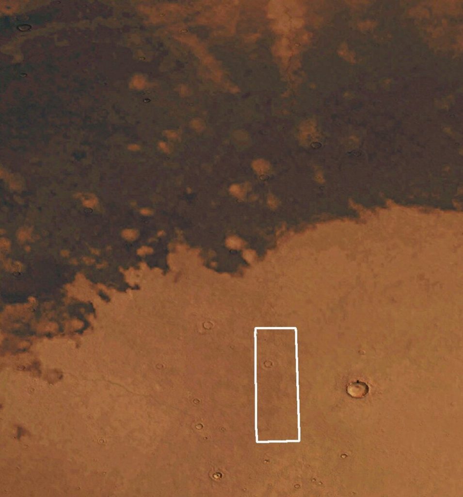 The Viking image of this patch of Mars. Credit: ESA
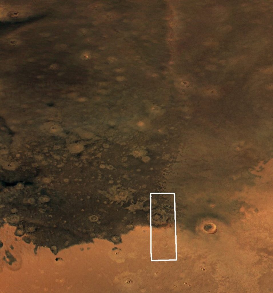 Comparing the Viking (left) and Mars Express (right) images of this patch of Mars. Credit: ESA
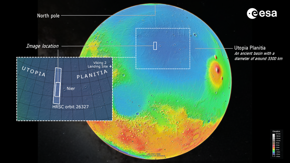
The star of the release is a simple, powerful comparison: a 1976 NASA Viking view of Utopia Planitia next to a fresh Mars Express High Resolution Stereo Camera (HRSC) frame. In the Viking era, the region looked mostly bright and dusty. In the new image, a broad swathe of terrain has turned almost black, coated or uncovered by ash.
 Zooming in on the white box marked in the Viking/Mars Express comparison. Credit: ESA
That contrast line is razor-sharp. On one side, tan sands. On the other, a smooth, dark sheet that looks almost like a lava flow in orbit shots, but is actually loose ash rich in mafic minerals such as olivine and pyroxene.
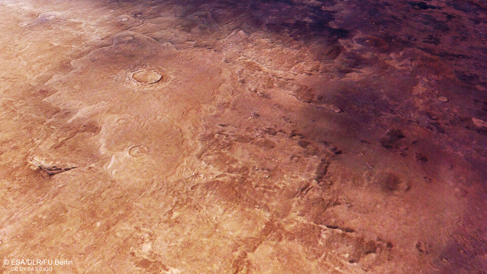
Crater Halo In a Sea of Ash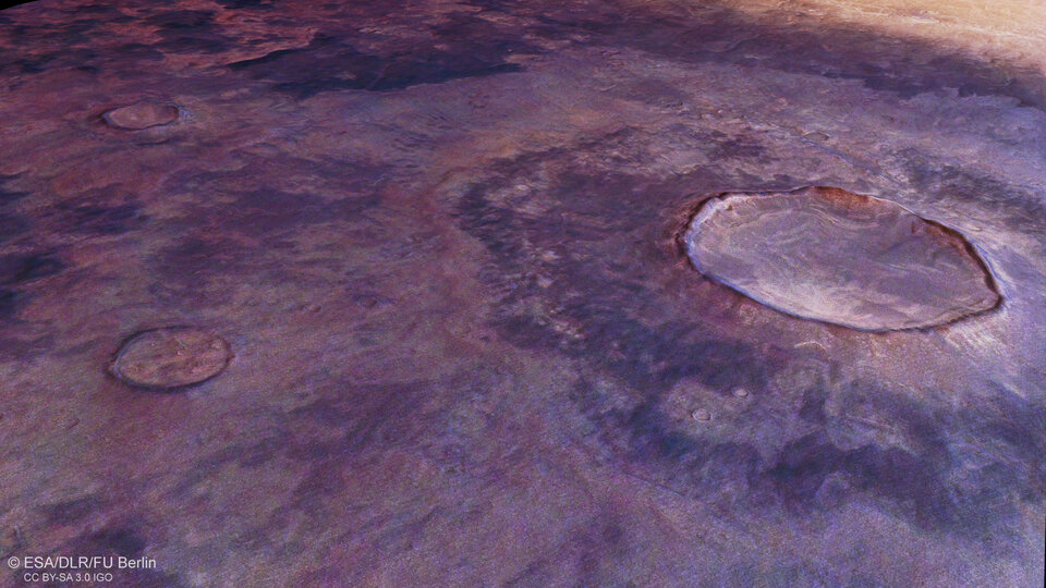 Bird’s-eye view of an impact crater on the ash-y side of the main image. Credit: ESA
A close-up HRSC view drops you over a 15‑kilometre crater sitting inside the dark terrain. The floor is streaked with squiggly textures carved by creeping, ice-rich material, while the rim is wrapped in a pale ejecta blanket that pops against the black background like a spotlight ring.
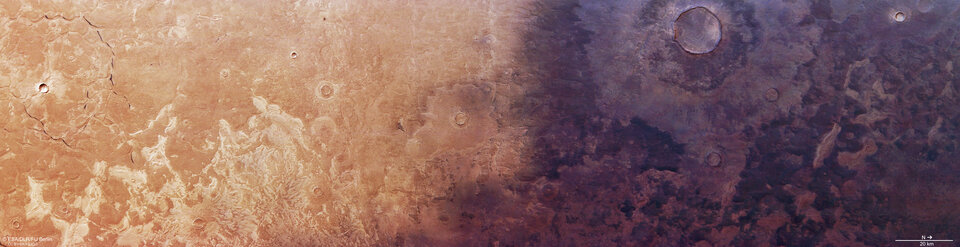
 A broader view of the patch of Mars shown in the main image, which lies within the Utopia Planitia basin. Credit: ESA
Another processed scene widens the field, revealing how the ash follows low-lying areas across Utopia Planitia, an ancient impact basin roughly twice the north–south span of the Sahara. A colourised topographic map shows subtle highs and lows steering this “dark tide” as it advances or is gradually unmasked by the wind.
Scallops, Fractures and a 3D Flyover Zooming in on the series of shadowy ditches that connect to form a rounded shape. Credit: ESA
In the darker half of the main image, HRSC resolves clusters of “scalloped depressions”. These are rounded pits with wavy rims that form as buried ice melts or escapes, causing the surface to sag. On the brighter side, long, shadowed grabens intersect in a maze-like pattern, hinting at older tectonic or sedimentary stresses under the ash veneer.
 Zooming in on a crater at the boundary between light and dark. Credit: ESA
ESA’s image set also includes a 3D rendering of the scene. It lets you virtually “fly” over Utopia Planitia’s mixed landscape of dunes, pits, fractures and ash sheets.
Even in a world where change usually hides on million‑year timescales, sometimes all it takes is a pair of images and a few decades to see Mars in motion.