
 Looking Like Bob Lazar Was Right")
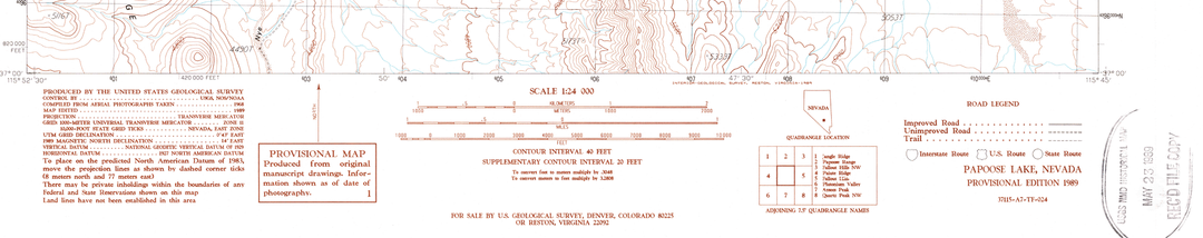
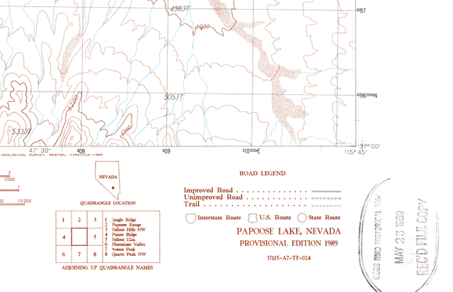
Pretty odd this topo map, which was created using aerial images taken in 1968, was edited on the exact day Bob Lazar went public. A preponderance of evidence indicates they had the whole cover story waiting in the wings, once the story dropped (the trigger), it went into motion.
Check out the stamp in the bottom right-hand corner vs. the text in the lower left legend/source area.
You can download your own copy for free from a .gov server.
by Crafty_Whereas6733
3 Comments
I get that the date matches but…. edited to what end? what was added? what was taken out? and what narrative does it imply? most people aren’t going to pull out a magnifying glass and go inch by inch analyzing this. Help us out 😀
how is this evidence? do you have a map from before may 1989 to see what has been edited? do you know what was edited exactly? nothing will ever appear to give him and his fantasy stories any credibility.
I mean we only had 3 congressional hearings, and at least 40 whistle-blowers, and 3 bipartisan disclosure bills, all within theblast 3 yets, all corroborating Вob Iazar’s underlying claims lol