

We obtained the Paleoindian Database of the Americas — 135,030 stone tools across 5,730 US counties — and mapped what happened to human populations across the Younger Dryas boundary at 12,800 BP.
The result really isn't what was expected.
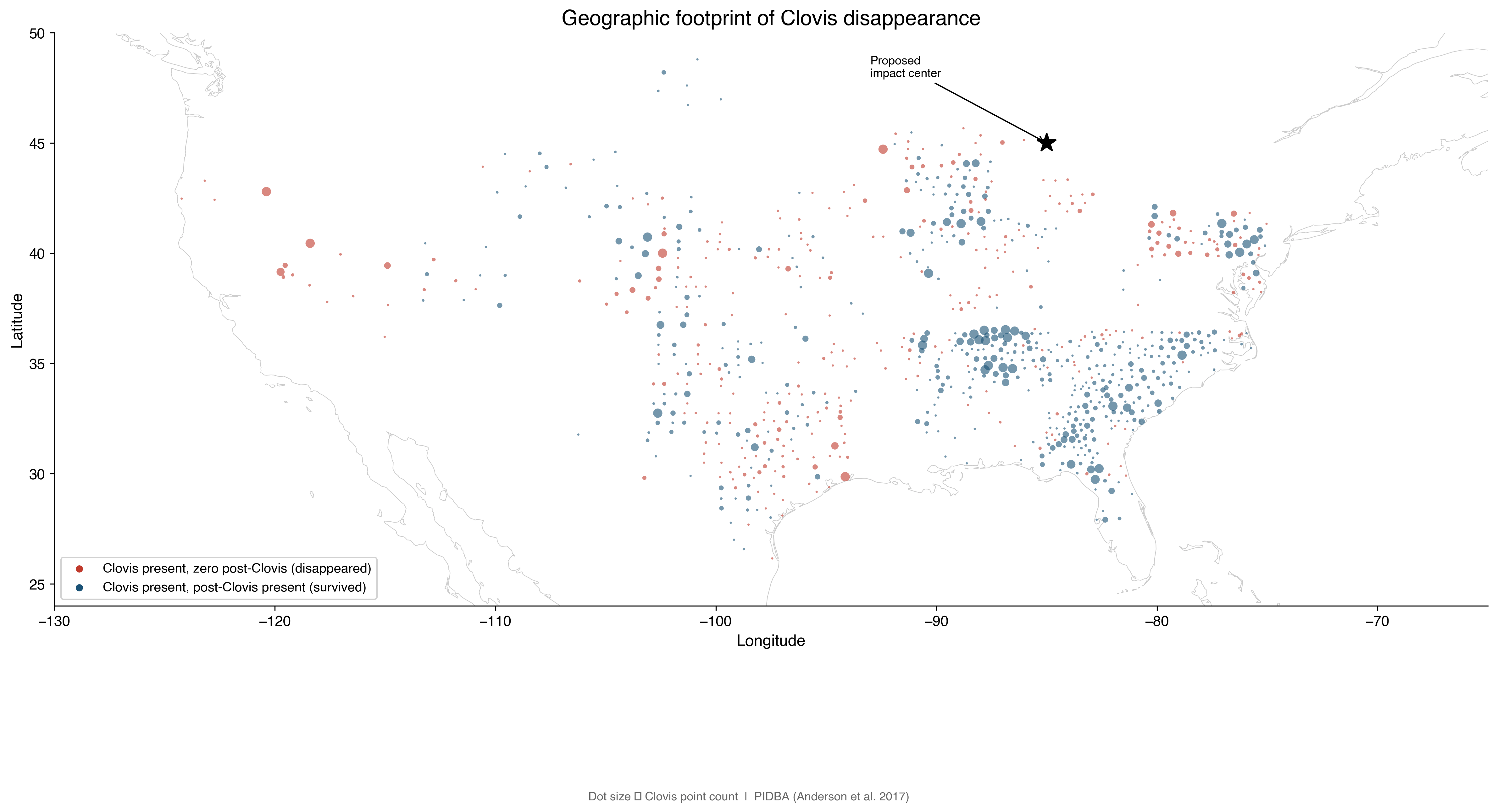
The Southeast exploded. South Carolina: 25.7x growth. Mississippi: 21.8x. The Carolina Bays region — often cited as evidence for a cosmic impact — shows the strongest population growth on the continent at 16.2x.
The Northeast collapsed. Michigan, Nevada, Oregon: total disappearance. Every Clovis toolmaker vanished.
We tested whether the pattern correlates with distance from the proposed impact site or with latitude. Latitude wins by a factor of 515. The demographic transition tracks climate perfectly — cold regions emptied, warm regions filled. No radial pattern from any impact centre.
The crash was instant in the north and permanent. The boom in the south was gradual over millennia…. you know what that is?
That's migration, not catastrophe.
Full analysis with maps and data: https://thegreatcircle.substack.com/p/the-impact-hypothesis-is-dead-apologies
by tractorboynyc
1 Comment
Can you explain your chart, OP?
“Clovis present, zero post-Clovis.”
Post-Clovis what? It can’t be post-Clovis points, because the next marker is post-Clovis something. Folsom points? What do these indicate? Why are the markers arranged on vertical and horizontal lines? Why do they correlate with the modern northern border of Tennesee?
A factor of 515 what?
Impact of a bolide? Why put it there?