

ICEYE US has been selected by NASA as one of seven commercial providers to supply satellite imagery under the agency’s Commercial Satellite Data Acquisition (CSDA) Program, expanding the availability of high-resolution synthetic aperture radar (SAR) data for scientific research.
The agreement enables NASA-funded investigators and their collaborators to access ICEYE US imagery through NASA’s CSDA Satellite Data Explorer and related data portals. The datasets include several imaging modes such as Spotlight, StripMap, Scan, Wide and Extended Spotlight, and Long-Dwell collections.
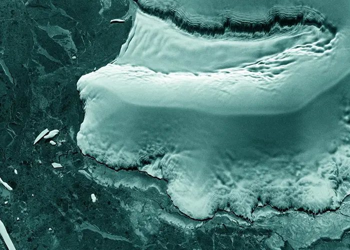
ICEYE’s SAR technology allows satellites to capture imagery regardless of weather conditions or lighting, making it particularly useful for monitoring dynamic Earth processes. Researchers use SAR data to study events and trends including flooding, land deformation, sea-ice movement and the impact of natural disasters on infrastructure.
The agreement also provides access to data collected by ICEYE US satellites operating in Ground Track Repeat orbits, which pass over the same locations at predictable intervals. This capability enables advanced analysis techniques such as interferometry and coherent change detection, allowing scientists to detect subtle changes in terrain, vegetation and infrastructure over time.
NASA established the CSDA Program through its Earth Science Division to evaluate and acquire commercial satellite data that can support scientific discovery and applications with societal benefits.
ICEYE US Chief Executive Officer Eric Jensen said the agreement reflects the increasing role of commercial Earth observation systems in supporting research and environmental monitoring.
“Being selected by NASA for the CSDA Program is a meaningful validation of the quality and mission relevance of our SAR capabilities,” Jensen said. “The science community relies on persistent, reliable Earth observation to understand our planet’s most dynamic processes.”
ICEYE operates a commercial constellation of SAR satellites designed to provide frequent monitoring of Earth’s surface. Through the new agreement, NASA researchers will be able to task new satellite collections and access archival SAR imagery to support a wide range of Earth science investigations.